Overview
The south-west of Western Australia is a global biodiversity hotspot where its high biodiversity suffers many threats. One of those threats is fragmentation of habitat owing to the large scale land clearing that was carried out in the 1950s and 1960s. This connectivity project aims to address this, and other threats, by restoring connections across a 70km swathe of farmland. Bush Heritage Australia has developed a Conservation Action Plan (using the Open Standards) in this area, where we are working to reconnect two large National Parks. The restoration of cleared farmland began with 60 hectares in 2003 and in 2018 a total of 2,500 hectares have been revegetated with varying levels of success. This project is focused on a 425-hectare restoration project on the Monjebup North property. The goal for this property was to reinstate as many species of native flora as possible, which in turn would provide habitat for the fauna known to inhabit the greater area. Plants were reinstated using both direct seeding and hand planting of seedlings over 4 years. Monitoring since 2012 has found that habitat structure is developing and many species of fauna have returned to the once cleared farmland.Project Details
Bush Heritage Australia
- National NGO
South Coast Natural Resource Management Marlak Pty Ld Threshold Environmental
Adaptive management
Describe adaptive management processes and mid-course corrections taken to address unforeseen challenges and improve outcomes in each of the following categories:
The key lessons learned by this project include:
Plantings that are too dense don't thrive, We have a lot more to learn about propagation, germination and seed treatment of our Australian native plant species, and Our native fauna responds quickly to the provision of suitable habitat.
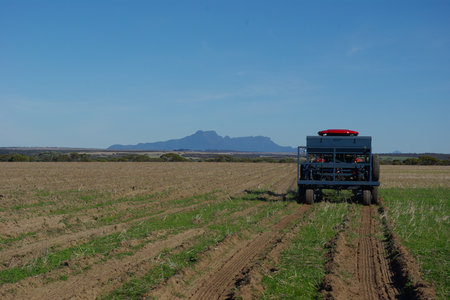
Our monitoring shows that plantings that achieve over 15,000 stems per hectare don't thrive as well as those that establish at a lower stem density. An exact stem density is difficult to achieve as germination is dependent on many factors and revegetation specialists can overcompensate for possible vagaries in weather. Dense germination results in high competition for soil moisture and light, it appears to also favour a high incidence of insect attack and disease. We are working with our contract revegetation specialists to ensure a results of <15,000 and >3,000 stems per hectare for future restoration projects.
Of the 590 plant species known to occur on the property only around 150 species were included in the restoration owing to a lack of knowledge of how to collect and treat their seed, germinate and/or propagate them. More research is required in this area to enable us to include a higher number of species in our restoration. A priority knowledge gap where research effort is being sought is the re-establishment of Restinaceae and Cyperceae species.
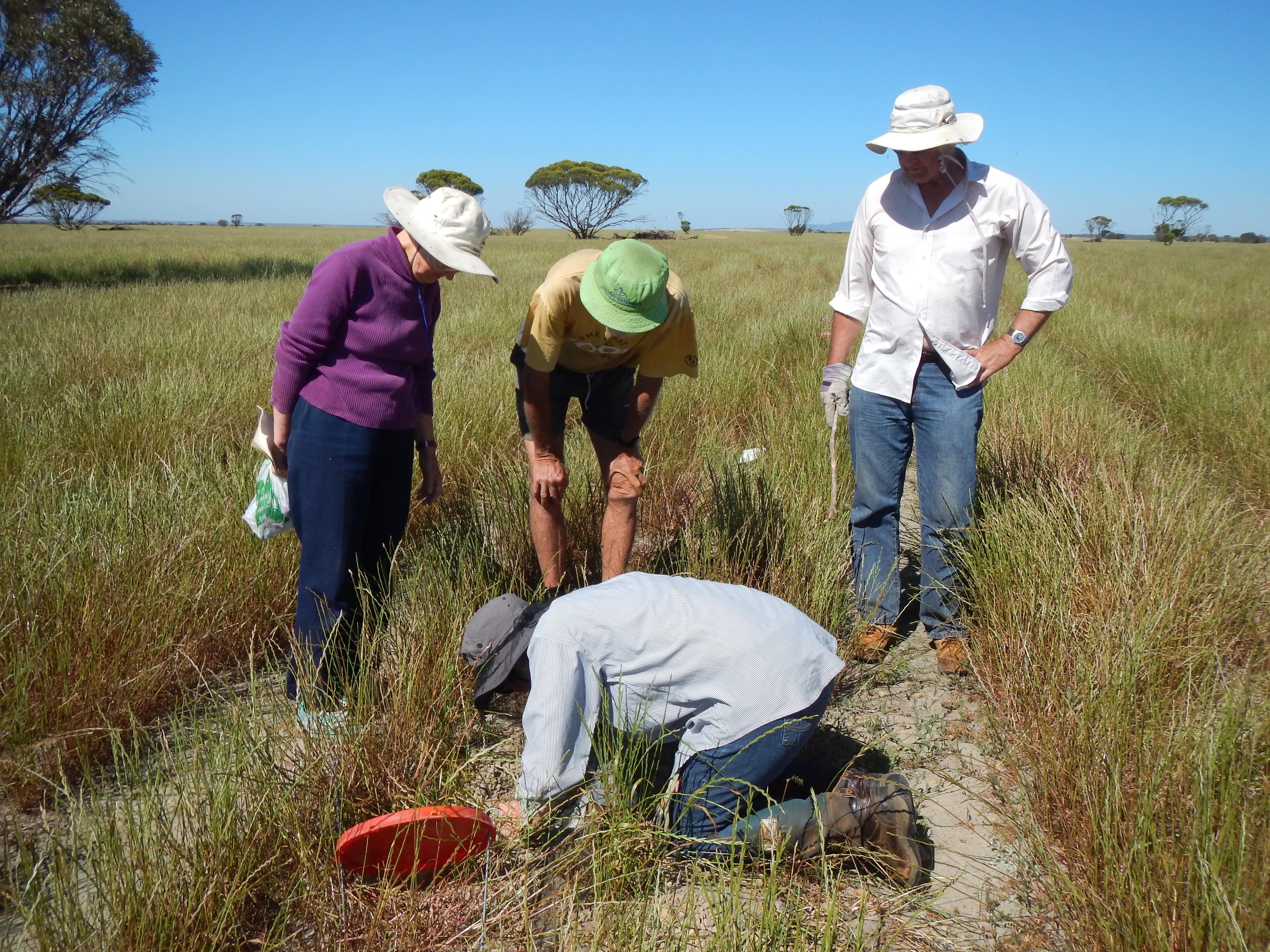
Australian native fauna have returned to the restored area sooner than predicted and we now need to examine in further detail the habitat requirements that are being exploited by each species and how we can improve or duplicate this in different vegetation systems.
- Closed/completed, no further follow-up
2010-01-01
2018-12-01
- USD 500,000-1 million
- National government and public institution
- Private donation
- Other
- Oceania
- Australia and New Zealand
- World
- Australia
- Temperate-boreal forests and woodlands biome
- 200-500 ha
- Other
- Other forms of unsustainable agricultural practices
The land was cleared of most of its native vegetation during the 1970s and 1980s, which was supported and encouraged by the State government of the time. The plant communities that were cleared included mallee heath and yate woodland. The land was growing cereal crops and sheep until 2012, which resulted in a severe loss of biodiversity, soil compaction, erosion and degradation of the soil profile as well as fragmentation of habitat between a large nature reserve and undisturbed bush land.
Goals and Objectives
unsure
YES
- The reference model is based on other diverse sources of information (e.g. other local or regional historical information, ecosystem classification systems, species range maps, successional models, Indigenous and Local Knowledge).
The reference ecosystem is based on diverse sources of information (e.g. multiple extant reference sites, field indicators, historical records, predictive data).
YES
- Other
The project's primary goals are to reinstate as many species of native flora as possible, which in turn will provide habitat for the fauna known to inhabit the greater area with the ultimate aim of reconnecting existing native bush land.
Long Term Management
- Other (please provide details)
The results from monitoring all the indicators are stored in Miradi software and are used to track progress and to provide adaptive management recommendations, i.e. fine-leaved eucalypts should be incorporated into all restoration for the use of pygmy possums for nesting material.
Angela Sanders
+61459190288
Bush Heritage Australia
Albany
STAPER
- A2. Identify/prioritize locations for meeting national contributions to Aichi Targets
- D2. Adjust plans, expectations, procedures, and monitoring through adaptive management